
Spring Creek Pass to Wolf Creek Pass: Section hike part 2
Part two of my Colorado adventure – two and a half days of CT followed by a few days of complete solitude and too much exposure up on the Divide
Day 8
Circus and I were both planning on hiking to the Colorado Trail Friends Yurt 8.6 miles from the pass, so we hiked together. What started as a discussion about the toxic masculinity that crops up in the long-distance hiking community became a long conversation about everything from wilderness therapy to phenomenology, patriarchy to climate change. We were fast friends. I had planned to deliberately avoid any hiking partners on this short trip, but Circus and I gelled and besides, I knew I would be on my own as soon as the CDT and CT split off two days ahead. A few miles in we pulled off on a jeep road to have a snack under cover of trees while a storm cell blew over.
We hiked into a massive herd of sheep, accompanied by two llamas, and rounded a corner into a saddle. We could see a little rectangular shack on the northwest side of the saddle. Didn’t look like any yurt I’d ever seen, so we poked around. Behind us, slightly up the hill, was the yurt, built out on a wooden deck. As soon as we closed the door behind us the rain and thunder returned.
Inside the yurt are four metal bunks, a few canvass cots, a plastic table and chairs, a woodstove, a washing sink, an assortment of kitchen utensils, propane lights, and logbooks. The sheep filled the valley with their bleating and I leafed through the logs from 2016 and 17, finding the names of friends, friends of friends: Dora, Beans, Mac, Appa. So many entries effused gratitude for salvation from inclement weather. Thanks to the yurt, to those who built it, those who maintain it, to the Trail. I added my own gratitude and call sign.

The height of luxury
Circus went down to the spring while I flipped pages, filling my bottles for me as well as his own. We ate our dinners and played a card game called Egyptian Rat Screw. Jackie and Chuck, the couple from Texas, turned up and suddenly the yurt felt small.
Day 9
The ground was frosted in the morning, but by the time we reached the high point of the CT it had long disappeared. There we encountered a father and son from Kansas driving a side by side – right on the damn trail. They thought it was a 4by4 road.
Circus and I made our way down to a junction in between a whole mess of old mining sites, talking mostly of video games we each grew up playing, and of Circus’s journey to become a firefighter back home. Bluebird day until about two in the afternoon – clouds rolled in but thunder held off.

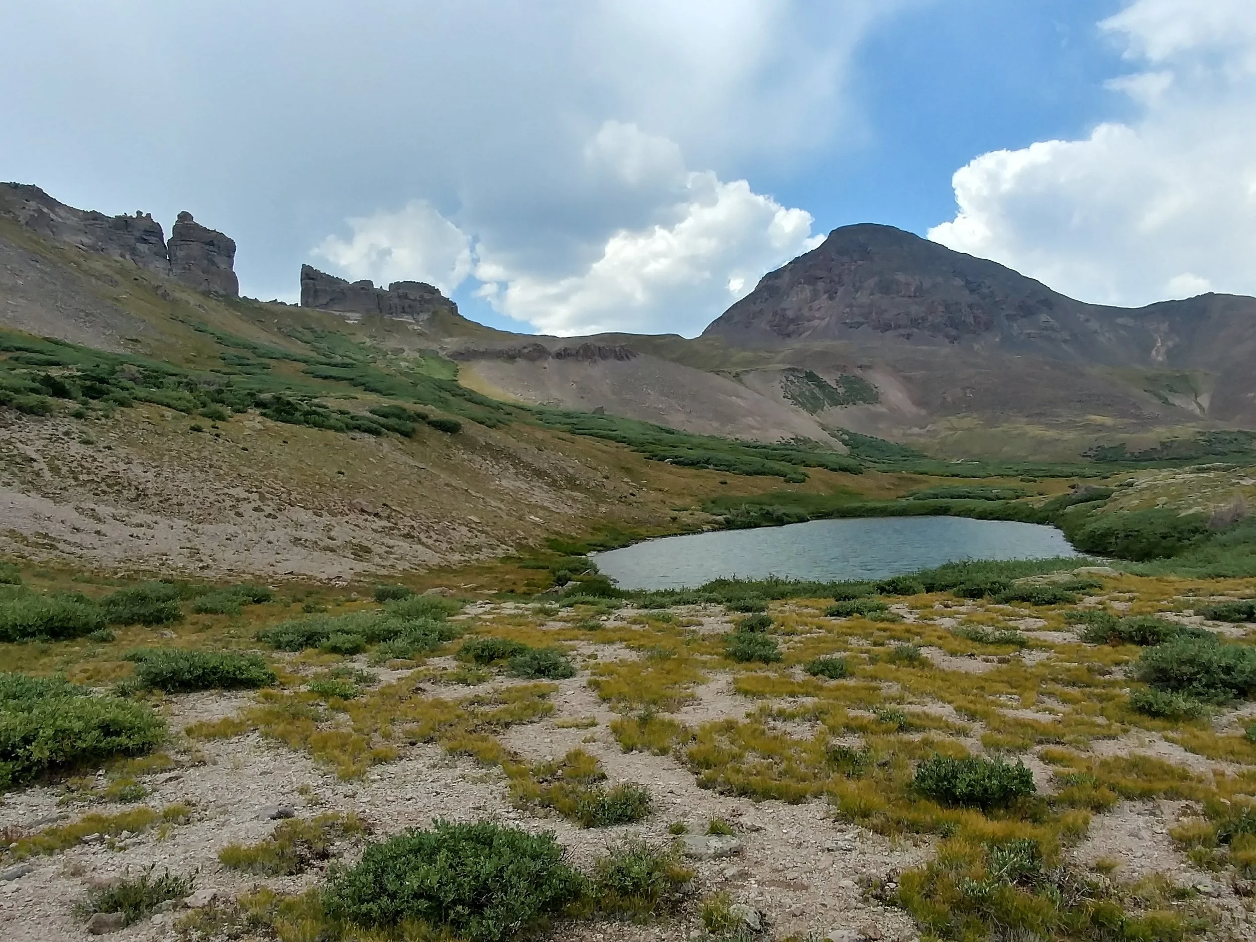
Cataract Lake
Lots of elevation gain: a real ass-kicker day. At Cataract Lake we broke away from the gorgeous, many colored peaks that we’d been gazing at to the north all day. The zero in Lake City had definitely done my body a favor or two, but the last four or five miles of the day were a struggle. To keep our minds off the climb, Circus entertained my questions about being raised Mormon in Virginia. I went to high school with a huge number of Mormon kids – many people don’t know that Las Vegas was a Mormon fort before any other colonizers showed up – so I know a fair amount of the fascinating peculiarities, but I’m always curious to talk with people who leave the faith they were raised in.
Just before the sun set we reached Cuba Gulch: “Tenting available in this area,” according to Guthook. He wasn’t wrong, but it certainly wasn’t an ideal campsite. Fairly exposed and far from flat, it would be home for the night. I had mistakenly thought it to be the night of the Perseids meteor shower peak, so Circus set an alarm for three in the morning so we could watch for shooting stars.

Circus for scale - one of the passes east of Cuba Gulch
I love the Perseids. The first time I experienced the shower’s peak was on a beach on the Atlantic with little light pollution and no prior experience with meteor showers. I was spellbound. Every year after I would look forward to the show only to be thwarted by: a) light pollution b) clouds c) full moon or d) all the above. On the CDT in 2016 I caught the best meteor shower of my life from Leadore, Idaho. Top Shelf, Anchor, LT and I all laid out on the lawn at the Inn in town (“City of Leadore: Population 105”) as meteors blazed green and orange tails across the entire dome of the sky.
This year was not quite as spectacular. Over the course of an hour we each saw roughly 45. Considering the peak wouldn’t occur for two more days, and that the atmosphere was full of smoke from countless fires across the west, I was pleased with that. By four am, clouds were rolling in and I slunk bank into my tent for much needed rest.
Day 10
Another cold, cold morning. Summer doesn’t last long in the Rockies. Still, five minutes of uphill hiking and I was stripping off my layers. I ate breakfast as I walked – I wanted to get in as many miles as I could whenever possible, knowing that storms on the Divide would probably hold me up and thwart my plans a few times between here and Wolf Creek Pass.
Five miles in we stopped at the source of the Rio Grande for water. Bill and Kirby rolled up, quickly followed by a hiker named Zorba. Zorba knows Circus from the AT.
“I’ve been seeing tons of hikers from our class out here,” said Zorba. He named a few hikers but only one caught my attention.
“Wait, Dogger – is he an older dude with a pink beard, hikes in a kilt, has some really odd leg tattoos?” I’d met Dogger in Ashland, Oregon on the PCT. On one calf is a tattoo of Snoopy as the Red Baron. On the other is a rather piggish cartoon bear spreading its butt cheeks…
“Yeah! And he has that laugh: hee-hew!”
“That laugh was my alarm clock once, just north of Crater Lake. My friends and I camped in a hollow just beyond a burn scar where all the cold settled. At 6:30 I was ripped from sleep by that laugh: ‘Hee-hew! Like walkin’ into a got-damn deep freeze! Hee-hee-hew!’”
The morning rolled along, the bluebird sky developing blotches of telltale signs. By lunch, a little beyond Stony Pass, the cumulonimbi had arrived. Circus and I sat on a boulder, marveling at the little pieces of infrastructure that composed the mountain shepherd’s summer home in the saddle below us. We checked the elevation profile. Up, then flat and exposed all the way to the CDT-CT split-off.
By now I knew I was going to Wolf Creek. I was always going to. On my Ley maps, a note marked an emergency shelter somewhere just off the Divide near the junction. I figured I would hustle that way and lay up in the shelter til the weather blew over.
After maybe a mile I was again hiking in hail. I turned on my boosters, knowing that power walking would get me farther quicker than the impulse to run. Not that there was anywhere to go, though, at least not for a few more miles. I must have been looking at the map incorrectly, because I reached the CT junction without seeing any shelter. I waited for Circus and Zorba so I could wish them happy trails for their last section, and then headed downhill towards Beartown Trailhead and the border of the Weminuche Wilderness, the bounds of which I’d be within until Wolf Creek Pass. Here goes nothing, I thought, may Zeus have mercy on me.

Happy trails, amigos. I’m off to get fried by Hephaestus’s bolts
I did see an old mining shack up against a beautifully multicolored rock face, a ways off trail across what looked to be a boggy willow-filled ravine. Didn’t really seem like an emergency shelter so much as a relic of a bygone era, and I was descending rapidly anyway, so I kept on.
A number of cars were parked at the trailhead, but I didn’t run into any humans. I hung out in a stand of trees and listened to the thunder’s afternoon soliloquy while eating lunch. At one point I thought I smelled chlorine, which I figure was ozone, though lightning wasn’t striking anywhere within three miles of where I sat.
There in that stand of trees began Round One of the game I’d be playing for the next ninety miles or so. I was only three miles from where I planned to camp, and it was only about three in the afternoon, so I took a long break waiting for clearer skies. One storm cell blew through, so I started hiking up toward Hunchback Pass. After only a half mile, I stopped to collect and filter water, at which point another cell arrived. I thought about heading back to my little hiding place, but daylight was burning quickly. I went another quarter mile to tree line, and from there I could see lightning strike the pass. Let’s play it safe, I said to the mountains, and I sat down between some krumholtz trees.
It only took about 15 minutes for me to realize I was about to get pinched by three different systems. I hurried down to a lower grove of dwarfed trees, ditched all my metal gear and sat on my pack. Ear splitting thunder erupted behind me, then from all directions, so I assumed the position (now, there’s no evidence that the lightning position or placing your metal things 100 feet away from you will actually lower your chances of being struck by lightning, but for me, if I’ve already decided I’m staying put, I figure it’s worth a shot).
I stayed like that, getting absolutely drenched by hail and graupel for about 45 minutes. I cursed myself for not shooting over the pass when I had the chance. There was a brief intermission (long lines at the bar and bathroom, of course), and a cursory survey of the sky let me know I was in for more, and worse. I wrapped the footprint of my tent around my waist, a makeshift rain skirt, grabbed all my stuff – even the metal – and booked it downhill to more substantial cover. Every foot of elevation lost helped ease my nerves, if only slightly.
My new spot was quite sloped, so it was tough to keep the balls of my feet together without putting my heels down, but self-preservation instinct trumped discomfort. I spent the next hour jack-hammering to stay warm, covering my ears as lightning crashed down within a half mile, then nearer. I began to chatter out a mantra: please, please, please. A little prayer to the universe, I guess. I’m not ready to stop. I want to keep going. I need this storm to pass over me. Laura’s not ready to lose me. I need to see Laura.

Everything’s just hunky dory over here, folks.
At long last, I saw that the sky was ever so slightly lighter and, thrilled to be alive but soaked and freezing, I lit out toward Hunchback Pass. The thunder maintained its frequency, but sounded farther off with each blast. I adopted a new mantra: gratitude. I was grateful to the storm, to electrons, to all the matter, antimatter and energy in the universe. I was thankful for every single phenomenon that shaped the experiential world in such a way that allowed me to hike on without having been vaporized by lightning: for climate change, for the California wildfires, and for the pastor I hitchhiked with, who spoke a prayer on my behalf to a god I don’t believe in. I hiked through the willow carwash, becoming even wetter than I had been during the worst of the storm, singing.
I found a campsite right by Nebo Creek, right where I had planned to stay. I pitched my tent, cooked as quickly as I could, changed, ate, and rolled out my legs. After a glorious fuchsia sunset, the wind picked up and rain fell in sheets. I started talking to no one again – maybe to the mountains themselves: Please just let me make it to Wolf Creek Pass and home to Laura. I won’t need to come back here, I’ll be done. Let me return home to the PNW.
Dramatic? Maybe. You weren’t there, though. The coyotes howled me a lullaby, and I think one came through camp - to tuck me in, I figured. The beetle-killed widow-maker trees creaked their own eulogies all night long, threatening to take me with them. I took one last look at my maps to plot my days around exposure. If I hike 20 tomorrow, the Knife Edge will be 17 miles away – awkward spacing no matter how you… slice it… What to do… Weather is everything.
Day 11
I woke and dug the easiest cathole I’ve ever dug in Colorado. Good sign. I broke camp quickly and hustled up the next pass. Somewhere around West Ute Lake I walked into a patch of willows casting the most beautiful shadow patchwork in the morning light. I pulled out my camera and started filming. Three steps later I saw an adolescent moose maybe 10 feet to the left of the trail. Make that two adolescent moose. Shit, where’s mom?
“Hey there cousins. It’s okay. I don’t mean you any harm. Couldn’t hurt you even if I wanted to.” My words didn’t seem to alarm them, but they did slowly begin moving away. That’s when I saw the mother, even closer to me, just on the other side of the willows, quietly munching her breakfast.
I’ve encountered a lot of moose in the Rockies, but only one other mom with a calf. You may have heard that cow moose with calves are among the most dangerous megafauna out there; moose are, after all, enormous relics of the Pleistocene era with remarkably sharp hooves attached to remarkably strong legs.
My experiences with the more-than-human members of our planetary community have reinforced the idea that beneath our abstract language and all the space we’ve constructed to distance ourselves from the rest of nature is an ability to communicate. These moose were not threatening me, nor did they seem to feel threatened by me. To be fair, these calves were not babies anymore, but they were young enough to be under mom’s care. If she had perceived me as a threat, she could have kicked me into oblivion from where she stood. Instead, the trio calmly moved downhill and out of sight.
I’ve had encounters with moose that made me feel uneasy, and I’ve had meetings as comfortable as this one. I’m sure lots of folks can relate: think of all the dogs you’ve met in your life. They can read your body language, and if you can be bothered to pay attention, you can read theirs. (to see the video, head to Instagram)
I hiked through the morning with a clear mind, that treasured state of doing-nothing that I’m always trying to cultivate on trail. After crossing a valley I found myself on a ridge above Ute Lake, Rio Grande Pyramid and the Window looming ahead. I heard my stomach calling for lunch, so I looked to the sky: cumulus clouds beginning to pile into one another (cumulus congestus clouds). I’d learned by this point that these clouds often presage cumulonimbus clouds, those anvil-looking suckers that birth lightning. They all seemed to be flying southwest in a hurry, piling up a good distance beyond my current position, and I was turning eastward. Maybe I’d lucked out this time.
I kept hiking until I reached the base of the next climb up the Divide, just beyond Flint Creek Junction. Ten miles from camp. I was rapidly approaching tree line and I didn’t want to get much higher. Obviously it’s better to be prepared and to have developed the skills to recognize dangerous situations before they fully manifest, but it’s tough to break the thru-hiker mentality and pull off the trail before hearing a single clap of thunder just because the sky looks iffy. One of the hikers I met in Lake City told me they’d never bailed off a ridge in a storm that could kill them. I’ve been that person. I sat down to snack and I watched the clouds grow more and more menacing, though still heading away from where I needed to go. Decisions, decisions.
I hung out for the better part of an hour, pounding food and trying to solar charge the $17 external battery charger I’d bought in Lake City. It didn’t do shit. Guess this four-year-old solar panel is past its prime. The temperature dropped considerably, which provided slight vindication for my pit stop. Eventually the clouds seemed to have moved on to the SW so I started on up. Halfway up the climb I realized that I’d been unable to see anything to the east, as I was up against the mountain: a realization hammered in by the arrival of hail.
Thunder was still far off to the southwest, miles away, so I kept on going up. On top of the Divide, finally able to see in all directions, I was still unsure: onward or back to “safety?” Blue skies were heading my direction, so I chose to hike the ridgeline above Ute Lake toward Rio Grande Pyramid – the views were stunning. This is why I came back, I thought, this is where the San Juans hype comes from. I stopped to get water as I rounded out the cirque, but then a batch of thunder cropped up. It never fucking ends! Better git along.

What’s that? Phallic? Really? I don’t see it.
I dropped to a saddle where there was much head-high scrub to offer at least the illusion of cover. The pass lay about 600 feet up, if memory serves me, and less than a mile ahead. Ley showed a scramble route to climb through the famous Window – it looked doable (by my standard, that is – when Ley describes a route as “doable” he means within the realm of possibility but mortally dangerous). I figured I’d get up to the split and play it by the weather.
I blasted up the incline, huffing and puffing, grunting even, as cumulonimbus clouds picked up my scent and signaled a chase. There was no obvious turnoff for the cross-country route to the Window, and I was much more concerned with getting to lower ground than choosing the most interesting path, so I motored on. At the top, I let fly a primal yell and then announced to the pikas and the scree: “This is your captain speaking: we have reached cruising altitude and are about to begin our initial descent. We may experience some turbulence as we try to stay in front of this thunderstorm. Drinks on me.”
I let gravity and the slope of the trail hurtle me down to the alpine meadows below. For the first time since I reached the Crazy Cook Monument, the southern terminus of the CDT, I felt like I had hiker legs. Rio Grande Pyramid stood proud against the swirling, turbid skies. In other conditions, I might have taken the cross-country route around its flank, but today I was happy to gaze at its reflection in the small lakes strewn about the basin.
Not bad, eh?
This is where I found them. I figured it was a mule train, or horse packers or something. Someone had abandoned a pair of shit-stained boxer briefs, as well as at least half a roll’s worth of toilet paper which had been soaked and dried, probably multiple times, and thus paper-machéd onto the fragile sub-alpine vegetation. I shouted at the absent offender: “WHAT THE FUCK IS WRONG WITH YOU?”
Accidents happen. I get that. It’s not shameful to lose control of your bowels. We’re all human and pants are artifacts, constructs. However, you should feel ashamed if you’re a grown-ass man who shits his pants and leaves them in a sensitive ecosystem for someone else to deal with. Pack that shit out (literally)! I assume it was a man because of the style of underwear, because men comprise a disproportionate percentage of wilderness area travelers, and because it just seems like the kind of garbage behavior that men more characteristically indulge in than women.
I pulled my gloves on and got a ziplock out. I did my best to get all the TP but it had basically fused with the grasses and it was seriously everywhere. I was heated.
I bombed downhill, losing probably 2,000 feet of elevation of the next couple miles. Near the bottom-out, on the edge of a meadow, mere feet from a creek, sat a surface poo atop a neatly folded pile of toilet paper. What kind of… I just… Where do you… UGH. The soil there was so loose that I was able to dig an LNT compliant cat hole with one trekking pole. I used a rock to bury the crap and hiked on.

First, I do it like this: I put a look on my face like I smelled some
Remember what I said about Coloradans telling me about how the thunderstorms operated like clockwork? I wish I could bring them all to the huge swampy meadow where, at six in the evening, I was drenched by rain, hiding under a bush as I watched lightning strike the CDT posts a few hundred yards away. Eventually I ran across to the trees on the other side, having to leap across the creek a few times. I grabbed a liter of water for camp and saw a beaver’s tail flash as they retreated to their lodge. Found a decent campsite, ate a quick dinner, made coffee for the morning to help me get moving before dawn. 54 miles to Wolf Creek Pass. Maybe the night time rain would mean clarity ahead. Not counting on it. Worst case would be a nine mile day to Squaw Pass, or a big bailout off the Divide. Otherwise it’s exposure, exposure, exposure ‘til beyond the Knife Edge.
Day 12
I beat the sun to the trail wearing leggings, rain jacket, and socks on my hands. I ate a PayDay for breakfast on the go. I spent the morning climbing, thinking about some legal snafus with the documentary and planning how to leverage Instagram posts for The Grounds Keepers for true waste solutions. The horizon in all directions was comprised of nearby jagged ridgelines, endless vistas whichever way you turn, and this morning it looked hazy, obscured by the smoke of distant fires.
On my way to Squaw Pass I surprised a couple mule deer on a cirque and got to enjoy watching them fly down a mile of trail. A few minutes later, around the next bend on a steep talus slope, a boulder the size of my backpack careened down the mountain, making impact directly on the trail about 70 feet in front of me before continuing on down the mountain out of sight. Phew.
Only after I crossed the pass could I see the clouds that had been quietly brewing mischief. I know, right? Getting old. I was sick of it, too.
I made it halfway up the next climb before taking cover. It looked rough, so I did all the precautionary crap and spent the next three hours with my footprint strung up as a tarp shelter as the sky threw a magnificent tantrum. I got very acquainted with the view across Squaw Creek Valley. I was glad to be warm and dry throughout the show, but I was getting antsy and frustrated that my 30 mile day pace had been kneecapped. I wouldn’t have gone that far, of course, but it still irked me.

Lightning struck those peaks over and over and over.
I eventually got fed up and made a break for it, and my timing couldn’t have been better. I didn’t catch a drop of rain or hear thunder once after cresting the ridge. I worked my way to the Knife Edge and was immediately thankful to be there without the company of thunder and lightning. The view was stunning, as was the sheerness of the drop to the left of the trail. On the way out to the point the trail crosses some sketchy little scree patches, and some of the underbrush has overgrown the trail, making for a less than sure footed traverse. I sat for a few minutes at the promontory, trying to see beyond the peaks to the foothills and plains of eastern Colorado.
I made camp in a saddle of uneven grass tussocks, and just after zipping my rainfly I heard elk bugling, followed by coyotes celebrating a kill. Two days til Pagosa Springs, just enough food to get there. If weather inhibits me again, I might get a little thin on the way to the highway, but not to the point of danger. Hoping for good weather – need a big day.

Along the Knife Edge
Day 13
The CDT just follows the Divide here – views in all directions while I slapped the spine of the continent with my beaten, plodding feet. Bit of a roller coaster, which wore me out. This section, all its elevation changes and the general altitude have cooked me. As I trudged along I sprung grouse after grouse from the underbrush. It startles me pretty much every time, the helicopter sound coming seemingly out of nowhere. I kept hearing the sound of scree falling, but I could never find any visible slides. Kind of unsettling.

So when the lightning starts, you just take shelter! Easy enough!
There’s a sizable descent to Piedra Pass. It felt good to just bomb downhill after a morning of relentless climbs. I dropped down a little too far though. While following a creek I must have gotten too into the groove of descending and missed a turnoff. I had stayed on the better tread path, which apparently had been a mistake. I found myself in a valley south of the trail and thought, Now it feels like the CDT. Got lost by not turning off on an unmarked, overgrown trail. It was an easy fix, though. I just followed Turkey Creek up the valley to the pass.
At the pass I found a green metal hatch, about the size of a magazine, leaning up against a wooden post. No idea what it was, but I was happy to add some weight to all the microtrash I’d scooped up. As soon as I crossed the valley the wind picked up something fierce. Here we go again. I found a relatively level place to fast-fly pitch my tent (just the rainfly, footprint and poles). The moment I zipped the fly, rain drops began pelting it. The drum of rain against a tent wall is supremely satisfying, each drop reaffirming the magic of shelter. I donned my warm clothes and brewed a cup of coffee. The clouds turned to torrents as I read aloud from Mary Oliver’s Why I Wake Early. The wind howled in concert with the thunder, drowning out the crunches of my “Cajun sweet fire mix” lunch. Unable to see beyond my rainfly, I marveled at the many ground cover plants, names unknown to me: greens, pinks, golds, purples and fringing browns.
The sky was perfectly clear when I set off again, perhaps an hour later, but the cold of the dissipated storm lingered. I charged up the first third of the climb to the high point of the day, then stopped to get water. From there I felt sluggish and took many microbreaks. My stomach felt a bit off, which is never fun when staring up at a 1,500 foot ascent. At the top of Red something mountain the views were spectacular, but I didn’t dare to hang around. Wispy clouds were accumulating again, and the past few days had blasted any meteorological optimism straight out of me.
At the top of a gnarly red talus field, I caught sight of a brown and white stationary object a few hundred feet below. Was it a backpack? A rock? A deer maybe? Better not be a dead guy. I really don’t want to scramble down there and back up. I stood perfectly still, squinting at it, and eventually realized I was looking at a big horn sheep. I think the first I’d ever seen.
When I reached the highest point left before Wolf Creek Pass, I let out my best howl, which was answered by the coyote choir that seemed to be following me through the mountains.

Full zoom…
Around four, after some lovely ridge running, I reached the only tree covered island along this six mile stretch of exposed Divide. The clouds looked wispy, and it was nearly evening, so I felt hopeful. I dropped down to a saddle and, feeling a bit spent, stopped to take a micro break. I reached for my water bottle and it fell to the ground, so I sat down. That’s when it started raining again. I put my maps away and sang while I waited for it to pass over. But it didn’t.
An enormous mass of cumulonimbus clouds, a wall cloud, really, was cresting over the mountains I’d just come down from. Fuck. I threw my rain jacket and pack cover on and ducked beneath the smallest tree in a little thicket just beside the trail. Then came hail, with blue sky in every other part of the sky.
The first wave passed. It had looked like the clouds were going to bypass me to the north, but now I could see that they were all churning together, boiling electricity into knots. I jettisoned the metals again - why not - and snapped a few tree limbs so that I could actually fit underneath the tree (sorry) and clambered up onto my pack, ready to assume the position.
The next two hours were some of the most frightening and humbling of my life. It felt as though the storm was just sitting on top of me, waiting for a chance to wipe me off the face of the range. Lighting struck within a mile of me over and over and over. My feet and arm muscles were cramped from crouching and covering my ears. Once again pleading to the universe, jack-hammering from cold and thinking of Laura. Oh, please, creative force, powers that be, don’t strike me down. Please please please please please please please.
The sky lightened slightly on the ridge behind me, unwrapping beams of dusky purples, pink-oranges. It looked more like the glow of a wildfire than a sunset, and though I was glad it was the latter, I was not pleased to welcome night as I shivered away, hands over my ears (I guess I didn’t mention earlier – being struck by lightning can cause hearing loss). Just as the light slipped away, there was a gap in precipitation. I had wanted to go another six miles at least, but I’d been stopped dead. I made a mad dash to pitch my tent across the way with frozen fingers and to get my dry, warm clothes on. I ate Lebanese Peanut Bulgur in the dark and spoke my gratitude.
I’ve had my fill of lightning, thanks. I’ll be getting up as early as possible and bombing to the highway. One big climb to the Guthook-listed “viewpoint” (as if every step in the San Juan range isn’t a viewpoint) and the bump of elevation gain just shy of the pass. Water in about five miles. Phone at 8% battery when I turned it off, probably only worth a pic or two tomorrow.
In the middle of the night I was woken by the sound of hooves in flight inches from my tent – an elk or a deer. Glad they didn’t crush my skull.
Day 14
It wasn’t long before I reached the junction of the Creede Cutoff, officially marking the completion of the section I’d come to hike. I had what few snacks remained stuffed in my pockets and didn’t break stride to fuel up. The brush was still covered in rain drops, leaving me thoroughly soaked all morning. At Spotted Lake Outlet, I heard the birds cheeping a melody that reminded me of a song I’d managed to go this whole trip without thinking of… Keke, do you love me?
My memory of this stretch was inaccurate. I was hungry, tired and cold when I came thru last, but I had 2000 consecutive miles to build my legs up. This go around was much more taxing. I kept thinking I’d reached the point at which the trail plummets to the highway, only to be disappointed. Shortly before reaching the Weminuche Wilderness boundary, I acknowledged the three storm cells converging on the pass.
I would have almost been disappointed if I’d gotten off easy, I thought. Untrue, but it helped to think so. When I finally hit the radio tower, where the trail actually does start to descend, I was shuffle-running to stay ahead of the lightning. About a half mile down from the top, I saw a heavyset, middle-aged man wearing ankle weights struggling up the hill. He was wearing a Trump/Pence campaign hat. Leave it to a Trump supporter to hike up a mountain into three thunderstorms…
At the highway I was dismayed to see construction going on in the shoulder I had planned to hitch into Pagosa Springs from, and a highway patroller standing by. I walked up to her and asked what the deal was, and if I could hitch from there anyway. She said it’d be fine.
I didn’t even have to stick my thumb out – a couple across the highway at the trailhead with the big Continental Divide Trail map called me over – David, Pollyanna and their golden mix Huckleberry. They were kind enough to take me into town in their truck and even bought me lunch at Riff Raff Brewery. We had a lovely chat and afterward they took me to a motel so I could shower, weigh my trash, recuperate, and figure out just how the hell I’d find my way to Boulder, UT to visit my friends.

Not pictured: big metal hatch, all the poop-contaminated stuff
All in all I packed out less than four pounds of trash between Monarch and Wolf Creek Pass. It seemed an impossibly small number – there was so much garbage. The weight doesn’t convey the reality. Stay tuned for reflections on trash and Grounds Keeping!