Birthdays, Bears and Tempting Fate: E. Glacier to Many Glacier (Days 1-4)
I have to warn you: I don't have the words to even scratch the surface of the magnificence that one finds in damn near every inch of Glacier National Park (some exceptions include car tourism havens like the Many Glacier and Two Medicine campgrounds), but since this is the first section and arguably the most stunning stretch of the CDT, I'm going to give it a shot. In the future, I'll likely just be outlining my days with photo accompaniment, but who knows.
Day One: We got out of Anchor's parents' rental car at the Chief Mountain Customs station. The border patrol officer told us we could walk up to the "leaving the US" sign so long as we didn't cross the international border - otherwise we'd have to go through a customs inspection, which would have been tricky considering my passport is currently at my parents' house. We took the obligatory northern terminus pictures, said our thank-yous and good-byes and took our first steps down the trail. We were happy to see a CDT blaze on the first trail sign, as well as a Pacific Northwest Trail blaze. The first mile was full of jokes and nervous laughter; it certainly hadn't sunk in that we had just begun hiking between 2,700 and 3,000 miles (pending route choices) toward Mexico. The fact we were only hiking 13 miles that day to our designated campground, Mokowanis Junction, complete with privy and bear hang pole, didn't help to affirm this new reality.

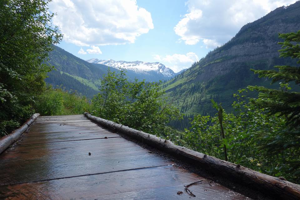
First of many bridges that can bear one hiker at a time and make one feel like a drunken sailor
It wasn't long before the trail opened up into an expanse of meadows erupting with wildflowers of all colors and bear grass in full bloom as high as my shoulders. Sheer, towering ridgelines and peaks lined the horizon in all directions and the Belly River ambled carelessly through the valley. I was awestruck. Dumbfounded. Flabbergasted, even. I wouldn't have been able to rid myself of the big fat cheesy grin spread across my cheeks had I wanted to.
About eight miles along Anchor and I stopped to examine a prodigious heap of, well, poop: definitely bear, almost certainly grizzly, very fresh. Meanwhile, not twenty yards behind us, Laugh Track and Top Shelf watched as two mature grizzlies grazed cow parsnip in a clearing below the trail. They tried to get our attention but didn't want to cause too much commotion. I admit, I was bummed to have missed the encounter.

Taken by Laugh Track
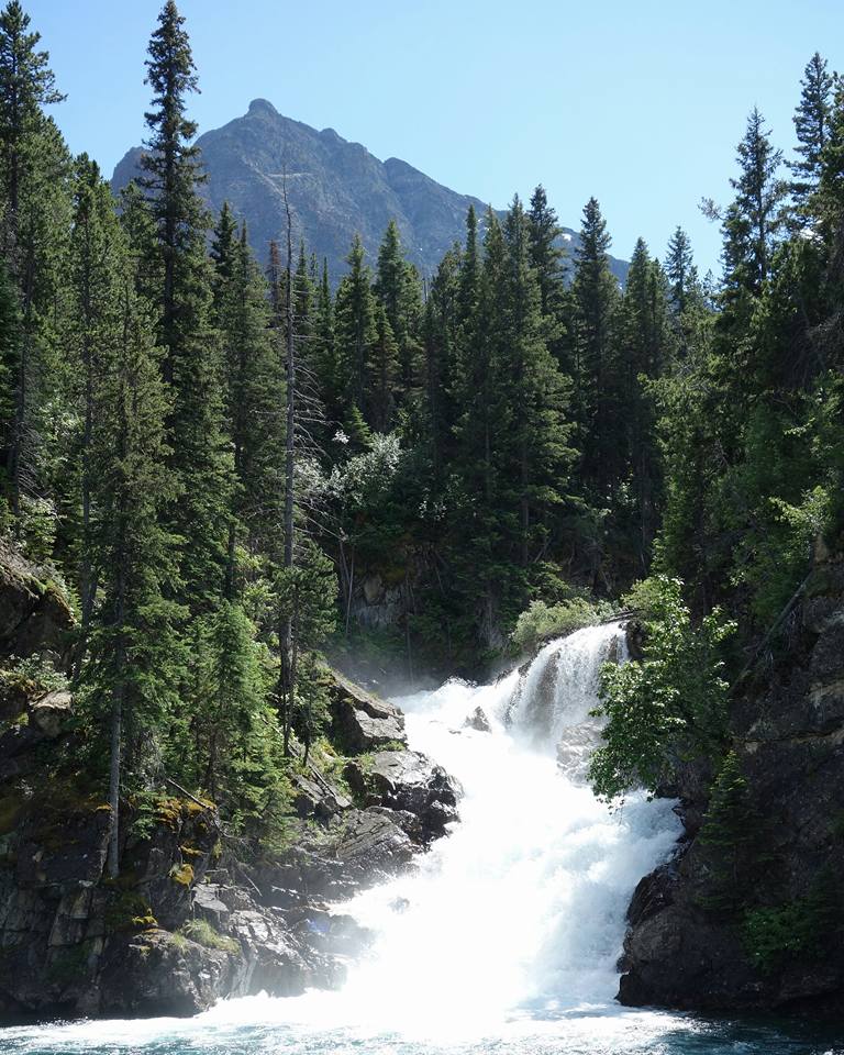
Every turn of the trail revealed further beauty: snow drifts on craggy mountainsides, glacial lakes both perfectly clear and impossibly blue, waterfalls in all directions, bucks and does, grouse and hawks.
Karma, Veggie, Crosby and Easily Distracted were at the campsite when we arrived, along with yet another triple-crowned lady out on the PNT: Coyote. I'd be lying if I said I didn't feel a little self conscious in their company, but they were all full of great advice about the CDT and a blast to hang around the food prep area with.
We hung our food bags - mine bursting at the seams as I had decided against mailing a box to Many Glacier and instead had packed out about eight days' worth of food - and retired to our little tents. It was nearly eleven but still too light to see the stars.
Day Two: I stayed in my tent 'til about eight am. It was my twenty-fourth birthday. The PNT hikers were already gone. Thanks to the Glacier permitting system, we only had 15 miles to go, but 5000 feet of elevation gain lay between us and our campsite. The approach to Stoney Indian Pass was graded fairly gently and we passed at least a dozen waterfalls. A few miles into the day we stopped and swam in an ice cold creek; once my brain thawed, I thought: this is what it's all about.
The last few hundred feet of the climb to the pass were buried in snow: our first little taste of route-finding. Aside from having a legitimate period to get into trail shape and ease my legs into the punishment of a thru-hike, it was nice to have such small mileage days in Glacier because there was always ample time to stop and take in the views. We must have spent an hour and a half atop Stoney Indian Pass, looking back at Glenn Lake in the valley we climbed out of and down to Stoney Indian Lake ahead of us.

Heading up to Stoney Indian Pass
Our route led us down the northwest side of the pass, which was covered in snow down to the lake: glissading time. I like to say that glissading is an anagram for assgliding; after all, it's simply the act of sliding down snow on your butt. We got to glissade down three big drifts, shaving off a steep climb and saving us some time. The lake was so high that it swallowed the trail at a few points and ice sheets had slid into the water, forming a floating white crust against the glacial blue.
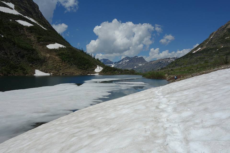
Stoney Indian Lake
From the foot of the lake we dropped something like 2500 feet to the junction of the Waterton trail, swimming through thimbleberry bushes up to my armpits most of the way. Laugh Track came upon another grizzly and scared it off with by making a ruckus with her trekking poles. I heard the bear crashing through the underbrush uphill (my direction…) but never saw it.
We met two backpackers, Paul and Colin, with many of the typical thru hiker markings - Granite Gear packs, Altra trail runners, Sawyer Squeeze water filters, long hair, shaggy beards and eyes that shone with expectation and humble ambition. They told us they heard a trail crew had accidentally blasted out part of the Highline Trail and that it was closed. We figured we would have heard about that and decided not to pay much credence. Laugh Track mentioned their semblence to hikertrash and joked about roping them into heading down to Mexico with us.
Climbing, climbing, climbing
We climbed for a few hours along an exposed ridge, which was hot but made for impeccable views. Eventually the trail switchbacked (switchedback?) us up into snowfields. We navigated mostly by hunch, finding the trail exposed every quarter mile or so, up to the ruins of an old stone structure, perhaps a former fire lookout. From that point on we wound up in the middle of a frozen lake and were forced to whip out the maps.

Old fire lookout, perhaps?
After a cold wet slog through slush and runoff, we made it to Fifty Mountain campsite. This spot was noted for having a lot of recent griz activity, but there were bear-boxes to store food and other smelly items like toothpaste, so no sweat. A buck and a doe putzed around the area while we ate, probably unaccustomed to seeing hikers in the area.

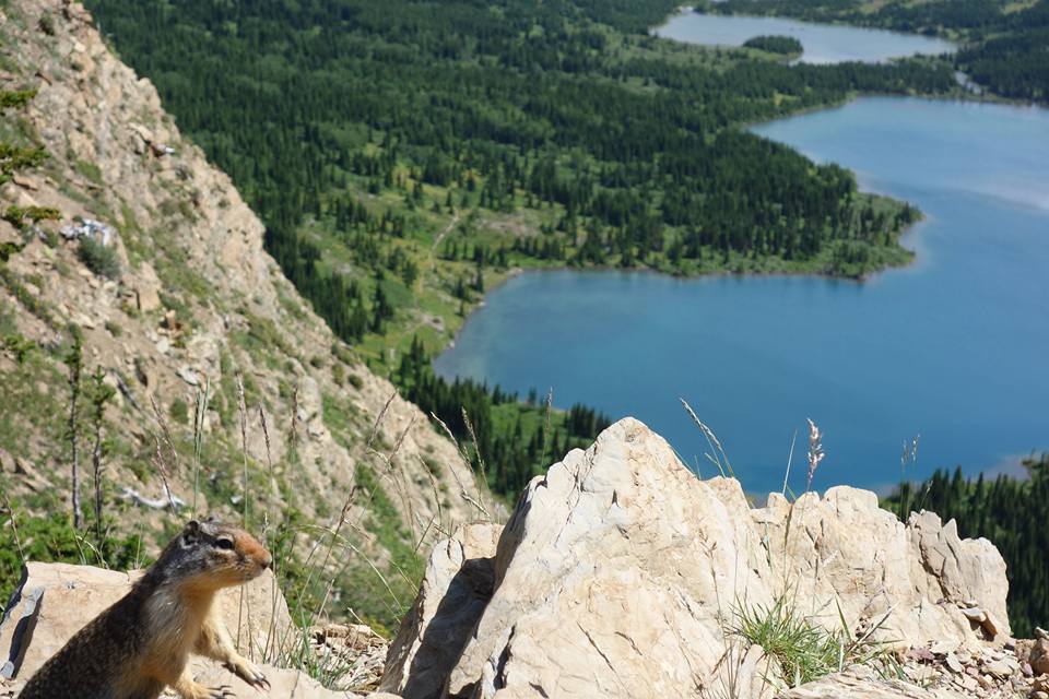
Curious fella
After the snow we had just seen, there was some serious talk about route options for the next day. The Highline Trail is up on exposed ridges and we'd heard quite a bit about a feature called the Ahern Drift from other hikers, rangers, the notes in our maps and Yogi's guidebook. It's a year-round snow drift that is said to sit at a 60 degree angle with a mortally dangerous slide should you slip. There was another way around, via the Flathead trail, but we didn’t have maps for it. We decided to sleep on it and decided in the morning.
I drank a birthday beer that Crosby had given me the night before and watched the sun go down. The sunset was magnificent, but the real show happened in the middle of the night. I was woken by a brilliant flash and the simultaneous urge to pee. I got out of my tent expecting towering cumulonimbus clouds but instead stumbled out beneath one of the most vivid displays of stars I've ever laid eyes on. Every few seconds the sky would turn white with energy from the east side of the Divide: either heat lightning or a storm far enough off that, though the flashes spread through the clear medium of night sky with ease, I could hear no thunder. It was one of the most peculiar and awe inspiring moments of my life.
Day Three: I woke up and LT had already broken down her tent and begun cooking her breakfast - it was now her twenty-fourth birthday, oddly enough. I choked down some oatmeal, my least favorite trail food ever. I only packed it because I had gotten it for free, and despite the delicious home-dehydrated honeycrisp apples, bananas and strawberries I added, it still sucked. We talked out our route options and decided that despite the risk of snow on exposed ridges for the whole Highline and my glaring lack of proper equipment, we preferred that option to taking a trail for which we didn't have proper maps that may have just as much snow. Besides, the Highline Trail is legendary. Top Shelf wasn't sold but they didn't want to split off, so up we went.
Within about a half mile of camp we were standing on a icy slope that ranged from at least 45° to around 60° with a long slide into rocks that didn't look fun. Three ice axes came out. Toppy put on their crampons (12 points of contact - we'd been calling them panther claws in jest but now I think we were all just envious), Anchor put on his micro spikes (think less intense crampons) and I started to feel slightly uncomfortable. Anchor cut out steps for us with his axe and we followed dutifully, placing each step with intention. I was jamming my trekking poles about a foot into the snow with each step to give me balance and something to hold on to in case I slipped. After the first twenty yards we were on skree; loose rock has never felt so firm and steadfast. That left about 500 yards to the saddle where the trail crosses the actual Continental Divide for the first time.
Safety third!
I took a few photos, of course, then shortened my left trekking pole - the uphill one - so that I'd have something at least a bit similar to an ice axe with which to self-arrest. While cutting steps is a game changer, the true reason for carrying an ice axe is to be able to stop an unintentional slide off the mountain.
I actually felt pretty good with my uneven pole system, and had absolutely entered "the zone": I was cool and collected, smiling even. What other choice was there? Fear wasn't going to help me make sure I stepped where I needed to.
When we crossed the Divide at that saddle, we found more drifts in our path. Slightly less precarious and with more gravelly skree patches of actual trail in between, but undesirable to say the least. Guess it was time to learn what this whole "embrace the brutality" concept was all about.

A few drifts in I lost my footing and fell to my knees, slamming my shortened left pole into the snow with as much force as I could muster. I was rooted to the spot and stood back up easily but my heart rate definitely spiked. I started thinking about some of the folks back home and how mad they would be if they could see me in this situation, but I looked around at the stunning panorama and just started laughing. The entire scenario was a bit surreal; the danger was no longer palpable. Besides, if the hype about the Ahern proved to be warranted, this part couldn't be all that bad, right?
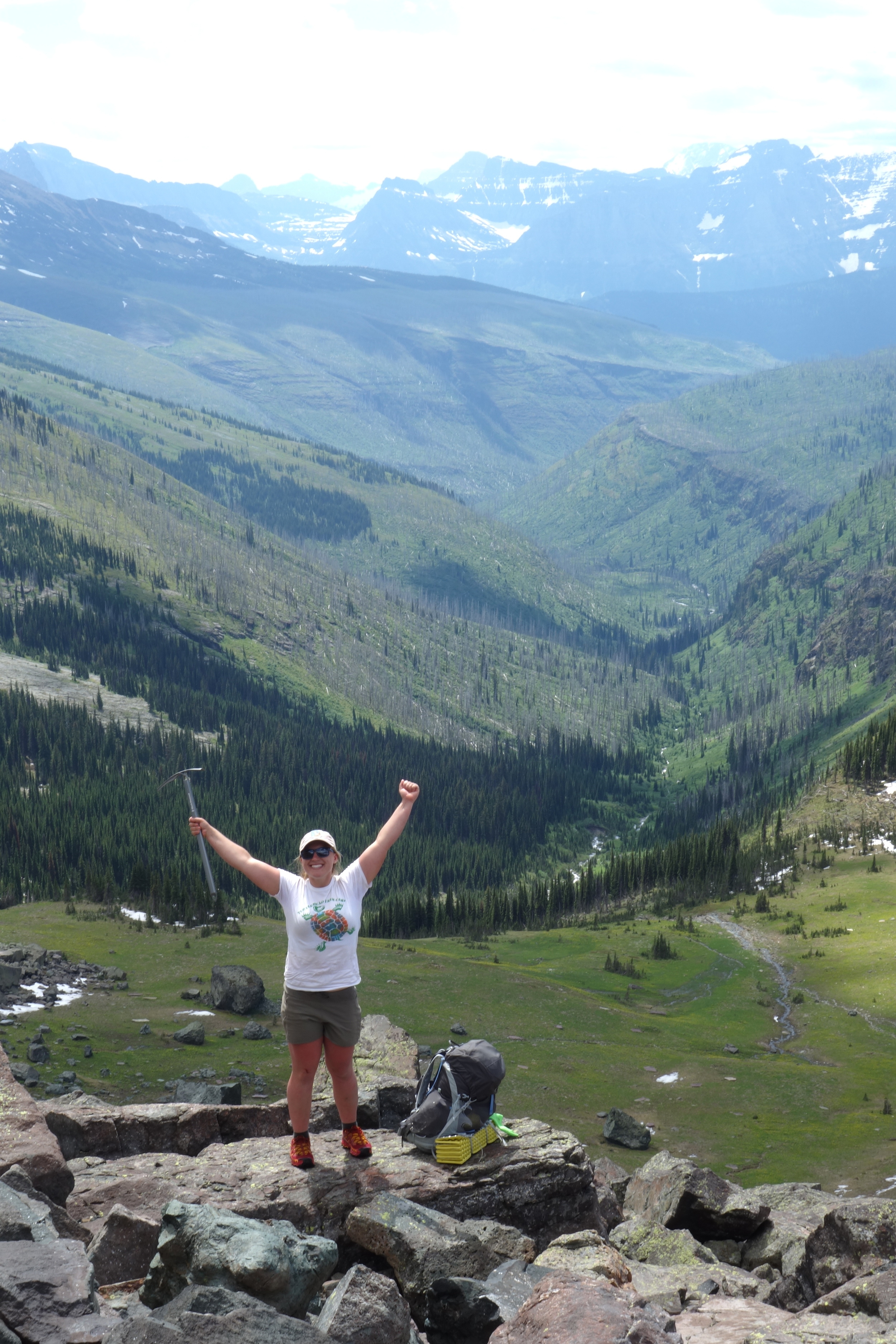
Laugh Track the superhuman birthday hiker, stoked to be on solid ground, holds her new best friend to the sky in triumph.
It took us two hours to go about two and a half miles, but we eventually found out feet on solid trail again. The next few miles were easy going and beautiful, despite crossing through a massive burn scar. We crossed over Cattle Queen Creek and the countless tributary waterfalls and cataracts that unite at the valley floor and I noticed some portentous cloud coverage rolling in. Not two minutes later: thunder on the other side of the Divide.
We checked our maps for the elevation profile for the next few miles: 500 more feet up and above tree line. Yikes. We hiked on, ears and eyes on high alert. A gentle mist gave way to downpour as the thunderclaps closed the distance between us.
"I don't want to be any higher than this 'til the storm blows over," I said to Anchor as I pulled on my rain jacket and my next-to-useless pack cover. He shook his head in agreement.
"Afternoon in the mountains," he said. A white flash ricocheted off the glistening talus slopes and thunder erupted so near that the ground shook. All four of us hastened to a stand of pines to wait out the weather. We were relieved to have gotten caught up in the mix before the Ahern traverse instead of halfway through.
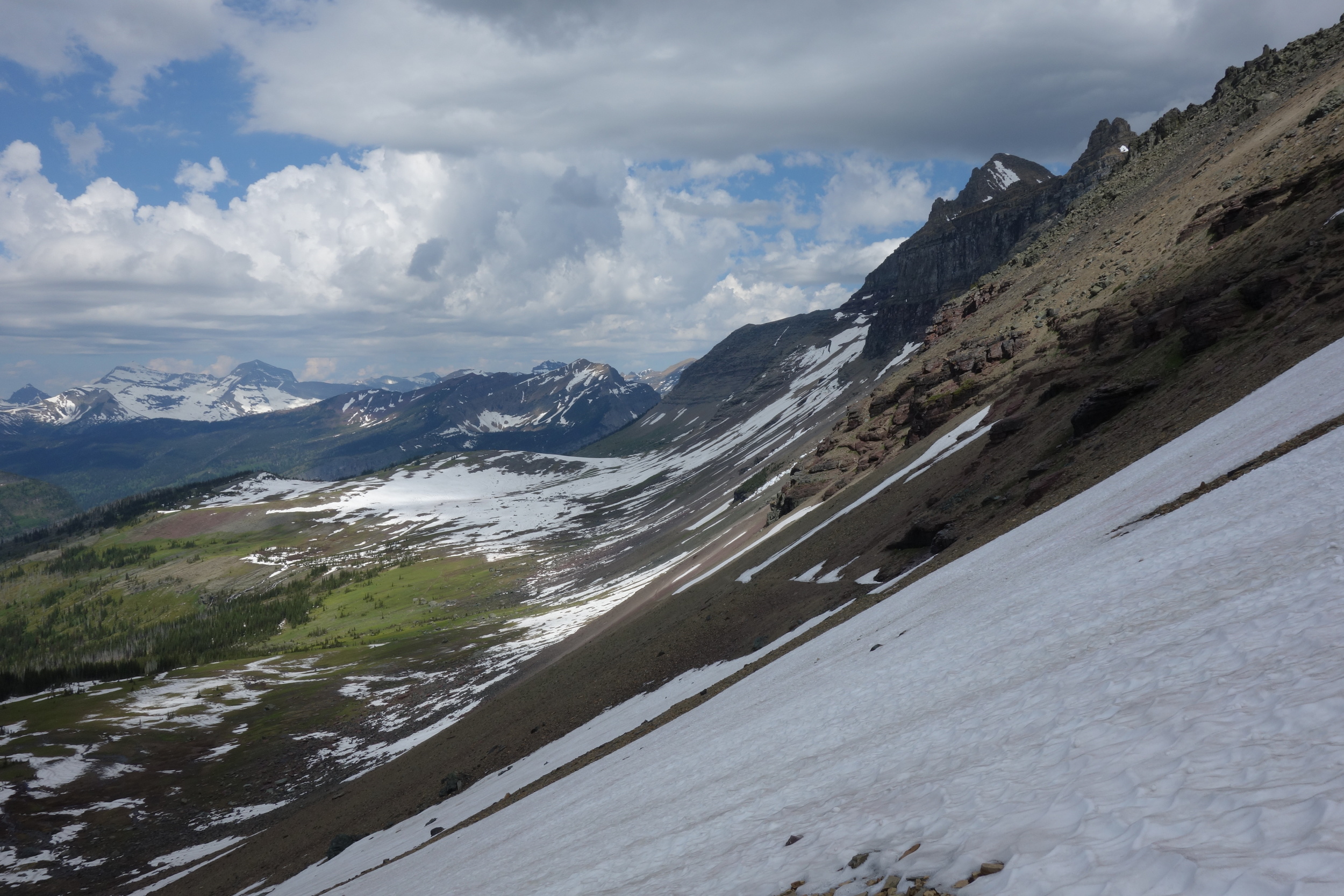
After climbing a few hundred more feet we got a view point of the dreaded Ahern Drift about three quarters of a mile away on trail, maybe a quarter mile as the crow flies directly on the other side of the valley. My first thought was that while the "sketchy" section looked to be longer than the reported twenty yards, it didn't look any worse overall than anything we'd traversed earlier that morning. It's not very easy to judge angles from such a distance, but I felt optimistic. Nonetheless, hiking around the ridge to the drift felt a bit like marching into battle.

Can you spot the trail?
After clambering over an expanse of avalanche/mudslide debris that buried the trail for a few hundred yards, we saw a single set of tracks across the drift: the one CDT hiker who'd been permitted to hike the Highline before us, one week prior. He may or may not have posted in the CDT Southbound Facebook group that no one ought to take that route… It was surprising to find his tracks still in the snow, as even hour old steps were melting out on other drifts. Part of what makes this section so dangerous is that the topography hides this drift from sunlight virtually twenty four hours a day, leaving it just wonderfully iced over.
We had previously talked about tying a line around one of the ice axes and hoisting it back to me after one of the other hikers cleared the drift, but this proved impossible, as the section we had to traverse was about sixty yards long. Oh well, left with no choice but to give it the ole college try and clutch to my makeshift trekking pole "axe" with all my might.

The easy part...
Anchor elected to lead the way, cutting steps out for us, as this whole fiasco had been his idea and he had been the one who talked the ranger into giving us the damn permit in the first place. At first we all felt perfectly comfortable - the snow was a bit crunchy but soft enough that I could have kicked steps if necessary and the angle was actually gentler than that which we'd begun with leaving camp that morning. About halfway across I realized we'd picked a bit too sharp an angle and were already level with where the snow met the trail and gave way to solid ground again, our trajectory leading us to the thin flake of snow against the mountainside from which we'd have to descend to the trail. It's a heck of a lot easier to maintain your footing while moving upward on snow than downward.
I called up to Anchor: "You're doing great Anchor, and I'm not trying to micromanage, but I think we're getting a little too high up here".
It was a bit too late to change course though, so we just hammered on forward. Eventually we were at the top of the flake, which we found out was only a few feet thick. I had been doing a great job of focusing solely on keeping solid footing, controlling my heartbeat and making sure I speared my poles down far enough into the ice to provide me a sturdy center of balance, but when Anchor told us his axe had punched through into the negative space below the drift, I realized my mouth was real dry and that my feet were cramping from having to contort them to match Anchor and LT's cut steps.
The four of us had piled up a bit at this point, betraying the plan to give one another enough space that a slip wouldn't bring down more than one hiker and to distribute our weight. The three of us in back were mighty quiet. When we reached the last twenty yards, we finally understood what Jonathan Ley (the man whose maps virtually all CDT hikers use and to whom we are all forever in debt) meant about the "sketchy" section. The angle of the drift here was about 65 degrees according to my compass, and a slide here would mean slamming into a few feet of talus and then careening thirty feet down onto the lower portion of the drift stippled with very pointy boulders. So close to the end, still so far from safety. I couldn’t help imagining how much worse this would have been had the thunderstorm caught us in that moment.
We inched forward, one foothold at a time, grabbing onto the top of the flake for support. Not fun. As Anchor made his first move downward toward the trail, he slipped. He slammed his axe into the ice and shouted, "No, you're not taking me now!" as he kicked his micro-spikes furiously to gain traction. It was a close call, even with the proper gear. He pulled himself up, cut a few more steps and performed a controlled slide to the trail and let loose a primal yell. He turned to us with his camera and said: "Smile!" I grimaced.

Photos can't do the slope justice
Laugh Track eased herself down to the trail gracefully and I took a couple deep breaths: no problem, I'm here now, and in ten seconds I'll be on solid rock. I moved as tentatively as possible, white knuckle grip on my trekking poles, and half-stepped half-slid the final few feet to the trail.
"Fuck that," I said. "So much." And I laughed as I looked out across the western Montana skyline, feeling more alive than ever. Toppy made it down with ease; there were no jokes about those panther claw crampons that day.
Not ten yards from where the trail picked up we saw black bear, mountain lion and big horn sheep prints right next to one another. Another few steps up, a large grizzly print. Anchor chiefed down a cigarette or two and pronounced that he was done with snow. Of course, we were still somewhere around 7,000 feet up, so he was sorely disappointed when we rounded the next bend.
Fortunately none of the snow we crossed from that point on was on a precarious slope. We dropped a fair amount of elevation down to our campsite, Granite Park. We saw a lone goat or sheep way up on the ridge on our way down and Anchor saw a golden eagle. Lucky guy.
When we got to the campground, there were two trail crew guys at the patrol cabin. They asked about the Ahern Drift, shocked that we'd come from that way; they were heading up to the edge the next day just to take pictures, as they were to be blasting it out next week with the same diesel/manure mix used to implode city buildings. They looked over our maps, pointing out highlights we had in store, and shared with us that not only had they been forced to spray a grizzly the day before, but that another griz had killed a mountain biker over near West Glacier the same day. He must have collided with it coming around a corner too fast. First fatal attack in Glacier in over ten years. I was saddened by the news, but didn't find my being out in griz country any more unsettling than I had before - this is their home, and the risk is assumed.

You know you're getting close to town when you can see this from your campsite (Granite Park Chalet)
Day Four: Seven-point-seven miles down into Many Glacier: a campground complete with motel, store and restaurant. We had an easy mile up to Swiftcurrent pass, from which we had sweeping views of the vallely in which Many Glacier and a host of gorgeous glacial lakes sit. We passed a few overnighters and more intrepid day hikers (or daywalkers, as we call them) who had come to see the top of the pass, and then began the quick drop to the valley floor. As we got nearer and nearer to town we ran into far more touristy types: people carrying babies in their arms, people wearing Budweiser cooler backpacks, people with nothing but a can of bear spray.
I wasn't the only one enjoying the view down to Many Glacier
We swam in a gorgeous and frigid lake. A middle aged guy whose group had given up before reaching the pass asked if it was cold. I said, "Nope, and it's not wet either." Fortunately my sass didn't register as rude, and he just chuckled. After drying off we hoofed it down to Many and went straight into the restaurant with our packs, in all our smelly, dirt covered glory. We ordered beers and I was thrilled to see both a vegan Caesar salad and a vegan tempeh reuben sandwich. We absolutely destroyed all the food and loitered a while trying to make use of the overburdened Wi-Fi.
We went hunting for the backpacker campsite and came across two rangers. The two women gladly directed us to our spot and were thrilled to hear we were going the distance (well, at least planning to) on the CDT. They, too, were shocked to hear that we'd hiked the Highline Trail.
"Uh, that trail is still closed," said one. We told her that Neil over in Two Medicine had permitted us and they lit up. As I mentioned before, the elderly badass who has run every trail in the park is quite the local favorite.
We ran into Paul and Colin - turns out they're thru hikers after all. They'd started from Waterton and, having been given bad information, were heading over to the Ptarmigan Tunnel. They had an adventurous day themselves, as the tunnel was still closed; they tried scrambling a side peak and ended up taking a bail-out trail down to the road, landing them in Many Glacier a day later than expected. The backcountry ranger simply threw them on our permit for the next few nights to skirt the issue of campsites being full. We ate at the restaurant once more and slept soundly, looking forward to the upcoming section back into East Glacier.